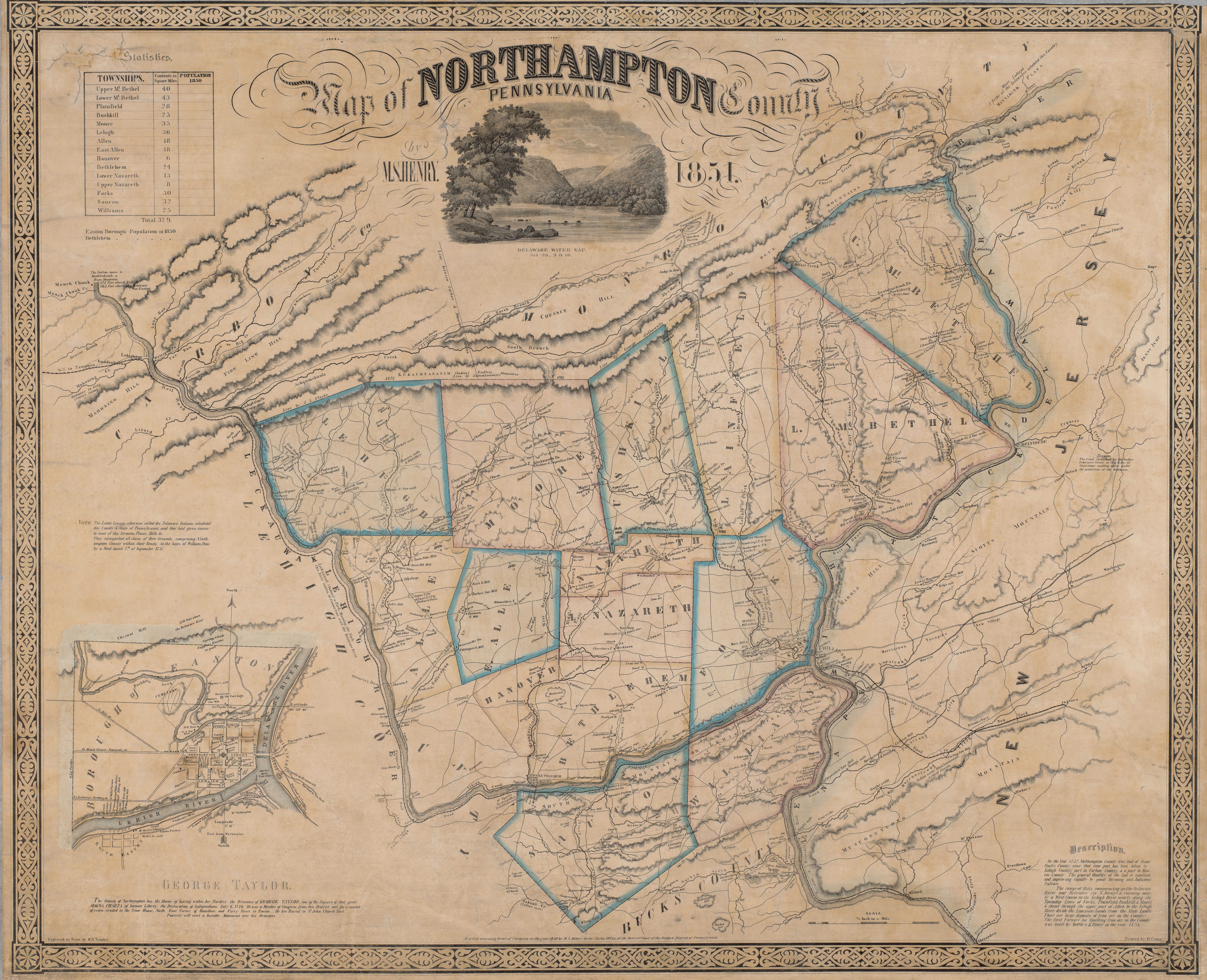
Northampton County Map (1851)
The original map of Northampton County was created by M.S. Henry, engraved by M.H. Traubel and printed by John Henry in 1851.
Please allow several moments for the map to load into the viewer below. You can use the zoom controls, arrows or mouse wheel to navigate. On mobile devices you can use your fingers to zoom in or move around.